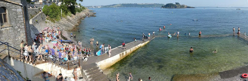
Firestone Bay has become an increasingly popular destination over the years and is frequented by family groups, swimmers, paddle boarders and divers
Plymouth Sound Club Members regularly dive in Firestone Bay and have created this page to share the most up-to-date information about Scuba Diving in Firestone Bay safely. The information and Images were provided by Keith Hiscock.
Firestone Bay including Eastern King Point (off the blue-door bathing huts) and off Devil’s Point Beach (below the Artillery Tower Restaurant) is a popular shore access dive. If you go there as newbies, do seek advice as there are hints and tips about timings and safety especially. Explore the area on foot to suss-out parking and access. The below information is provided for reference only and it is your responsibility to check that you have the necessary experience and follow safety procedures.
Firestone’ refers to the peculiar nature of limestone in Firestone Bay – it is shot through with iron oxide which is red. Such decorative limestone is used for fireplace surrounds
Diving in Firestone Bay
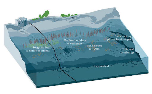
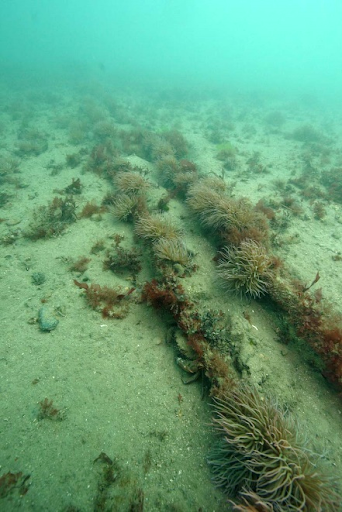
Many years ago, there was an internet-accessed guided tour of Firestone Bay with images of underwater scenery and marine life in different places etc. The above image was produced for that long-since lost site. It shows the line of the (disused) electricity main cable route from the Artillery Tower Restaurant to Drakes Island and the bathing huts in front of Nazareth House. ‘Deep seabed’ can be 40m. Now for the hints and tips (some are requirements!).
Important diving information for Firestone Bay
Check Shipping Traffic
Firestone Bay is within the Port of Plymouth which is under MoD control. The website lists Shipping Movements: “DIVING IS ONLY TO TAKE PLACE WITH PRIOR APPROVAL OF THE PORT OF PLYMOUTH CONTROL ROOM or LONG ROOM PCS.” Longroom (Port Control) can be contacted on 01752 836953. You may need to plan around shipping movements and there may be changes that Longroom can advise on.
Plan for the Tide
If you have permission, diving is best undertaken around high water slack – usually, be in the water about half an hour before high water and slack can be quite ‘tight’ on spring tides.
Plan your Route
Swim out along the seabed although you may wish to snorkel over the tall brown (tangley) seaweeds before dropping. Don’t swim out on the surface any distance (at least stay within the marked swimming area). Swim back to the shore (due north if you get lost) along the seabed. Surfacing off the shore is asking to be run-over! If you must surface offshore in an emergency, deploy a surface marker buoy.
You must have a compass with you and know how to use it. Take a bearing of the shore and use it for your return trip.
Entry
Entry from the walkway by the paddling pool takes you over the shore – go south-east to find the cables and follow them south (cables are under sediment in places). When you reach ‘the lump’, either head east over the cliffs and back north along them or keep going south – to the south-facing cliffs.
Entry
Entry from the blue-door bathing huts takes you to the cliffs to the east (swim south-east over the gradual slope then travel east at 12-20 m below sea level at high water). At the top of the steep slope/cliffs, go north-west to return to the shallows. Another route is to go west, over the gravelly area, onto the cliffs and further back to the paddling pool walkway
Site orientation
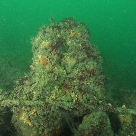
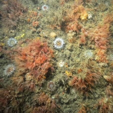
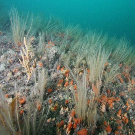
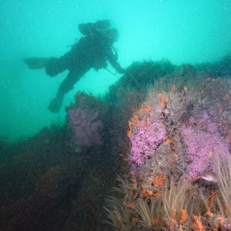
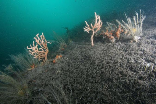
Easy to get to 30m depth – but you can just stay on the cliffs at about 15- 20m to see fabulous marine life!
Parking
Your greatest challenge may be to find a parking space. Some divers park in the Devil’s Point car park (max. 3 hrs free during the day) and walk fully kitted to the access points. The more savvy divers have a trolley. There are other ways but divers should not use the café car park!